As municipal zoning rules limit space for solar and wind projects, finding less disruptive locations with the aid of environmental and social data may become key to balancing renewable energy growth with local needs.
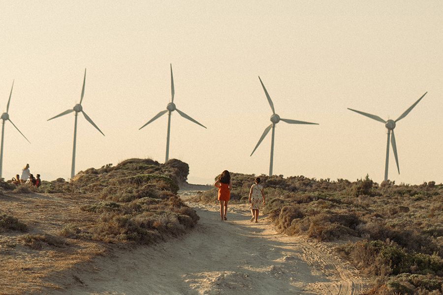
In the United States, setback ordinances—regulation issued by towns and counties to keep renewables projects at a safe distance from neighbouring properties and infrastructure—could reduce wind resources by 87% and solar by 38%, finds a study published in the journal Nature Energy by the National Renewable Energy Laboratory (NREL).
Such a deployment reduction would cut America’s renewable energy potential 42%—from 161 to 93 terawatts, reportsUtility Dive, noting that the last four years have seen an “explosion” of municipal setback ordinances restricting land for renewables projects.
Back in 2018, 286 ordinances were in place for wind turbine development. By 2022, that number grew to 1,853 for wind, plus another 839 restricting utility-scale solar.
Though setbacks are becoming less restrictive in response to housing shortages, and though NREL experts say the U.S. will meet its decarbonization targets even with 93 TW, that estimate does not reflect the impact of other municipal rules, like those that limit noise disturbance, writes Utility Dive.
The point of a setback for renewables is to “provide reasonable safety or other protections, in the same way that zoning ordinances establish reasonable guidelines for the construction and siting of other structures,” explained [pdf] the Pacific Northwest National Laboratory (PNNL) in a 2022 memo. “Reasonable setbacks can help ensure safety in the event of an unlikely but dangerous event, such as ice slinging from wind turbine blades or the detaching of a blade entirely.”
[Although some U.S. jurisdictions seem to have no such concern about siting oil and gas fracking wells within breathing distance of homes and schools—Ed.]
The American Planning Association recommends a standard setback of 1,000 feet (304 metres) for renewables installations, notes PNNL. But “many cities and counties have approved minimum setbacks much larger than 1,500 feet, which can restrict or in some cases altogether prohibit large renewable energy projects, in response to local concerns or pushback.”
Wind developers say a 1,500-foot (457-metre) setback requirement is the upper limit of what is workable for designing a utility-scale wind project. But one ordinance in place in Kosciusko County, Indiana, dictates that wind turbine generators, meteorological testing towers, and any associated features “shall be set back from any adjoining property lot line, road right-of-way, railroad right-of-way, or overhead electrical transmission or distribution lines a minimum distance of 3,960 feet (1,207 metres).”
Meanwhile, a setback ordinance in Montville, Maine, dictates a minimum buffer of one mile (1,600 metres) between a wind project’s boundary and a neighbouring property line.
NREL’s analysis is meant “to provide municipal leaders with better data to estimate the potential impact of enacting various local ordinances,” said Anthony Lopez, a senior researcher with the lab’s Strategic Energy Analysis Center.
But determining the appropriate setback will never be a matter of “one-size-fits-all,” said Peyton Siler Jones, sustainability program director for the National League of Cities.
“While the benefits of lower setbacks are numerous, there may be very good reasons to maintain higher setbacks in certain locations, especially if it’s protecting a natural resource,” said Jones. “Ideally, local leaders can understand the benefits of lowering setbacks by examining the local renewable energy and housing potential and determine what makes sense for their community given competing priorities.”
Such an effort to balance all stakeholder concerns—while pushing ahead to decarbonize energy systems—is at the heart of a strategy called “smart siting” of wind and solar projects. It was the governing principle in a successful collaboration between the county of Zadar, Croatia and The Nature Conservancy (TNC).
Zadar “boasts 2,000 hours of sunshine annually and has one of the windiest climates in Europe,” wrote the World Economic Forum (WEF) in a January post, “a location that was initially deemed ideal for developing renewable energy sites to meet Croatia’s aim to phase out coal by 2033.” But getting to deployment was complicated, because “over 50% of the county falls within the European Union’s Natura 2000 network of protected areas for biodiversity, and there were multiple stakeholders.”
In collaboration with Zadar, TNC produced a “smart siting blueprint,” an “overlapping series of maps depicting regional environmental and social data with those indicating solar and wind potential.” Some 22 individual datasets were used to make the maps, covering everything from bear habitats and bat colonies to valuable farmland and areas projected to yield large quantities of electricity or located close to the grid, says the WEF.
“The datasets were comprised of input from local experts and non-experts alike to identify and rank land with significant community value to be considered,” the WEF states. The blueprint ultimately identified enough suitable land for wind and solar installations in Zadar alone to meet half of Croatia’s 2030 target.
Back in the U.S., the Oregon Smart Siting Coalition (including the Defenders of Wildlife, the Natural Resources Defense Council, the Oregon Natural Desert Association, and Renewable Northwest) recently completed a community-wide consultation and has published its own voluntary renewable energy siting guidelines “to help expedite renewable energy development while improving community engagement and conserving Oregon’s natural and cultural resources.”
This story originally appeared at The Energy Mix and is republished here as part of Covering Climate Now, a global journalism collaboration strengthening coverage of the climate story.